


AI Drone Inspection: The Ultimate Business Guide
AI Drone Inspection: The Ultimate Business Guide
AI Drone Inspection: The Ultimate Business Guide
Inspecting wind turbines, bridges, power lines, and industrial facilities can be expensive, time-consuming, and risky. Traditional methods often require scaffolding, specialist access equipment, or temporary operational shutdowns.
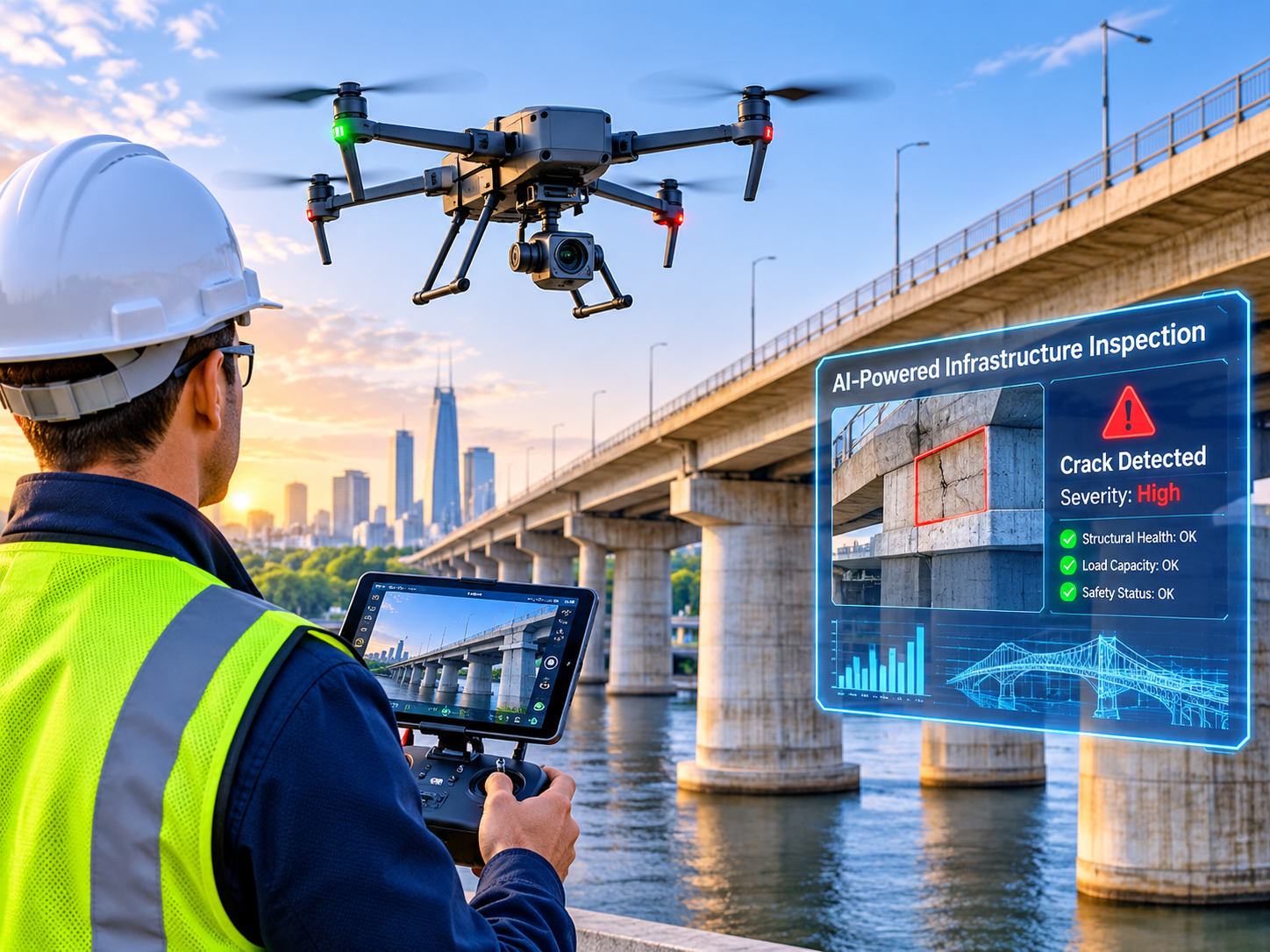
AI drone inspection offers a smarter way to assess infrastructure by combining aerial imaging, artificial intelligence, and automated data analysis. It helps businesses identify potential defects, create accurate maps, monitor asset conditions, and plan maintenance without relying entirely on manual inspections.
For infrastructure operators across the USA, UK, Germany, and wider Europe, the real advantage goes beyond capturing aerial photographs. It’s about turning inspection data into practical decisions that improve safety, maintenance efficiency, and asset visibility.
What Is AI Drone Inspection and How Does It Work?
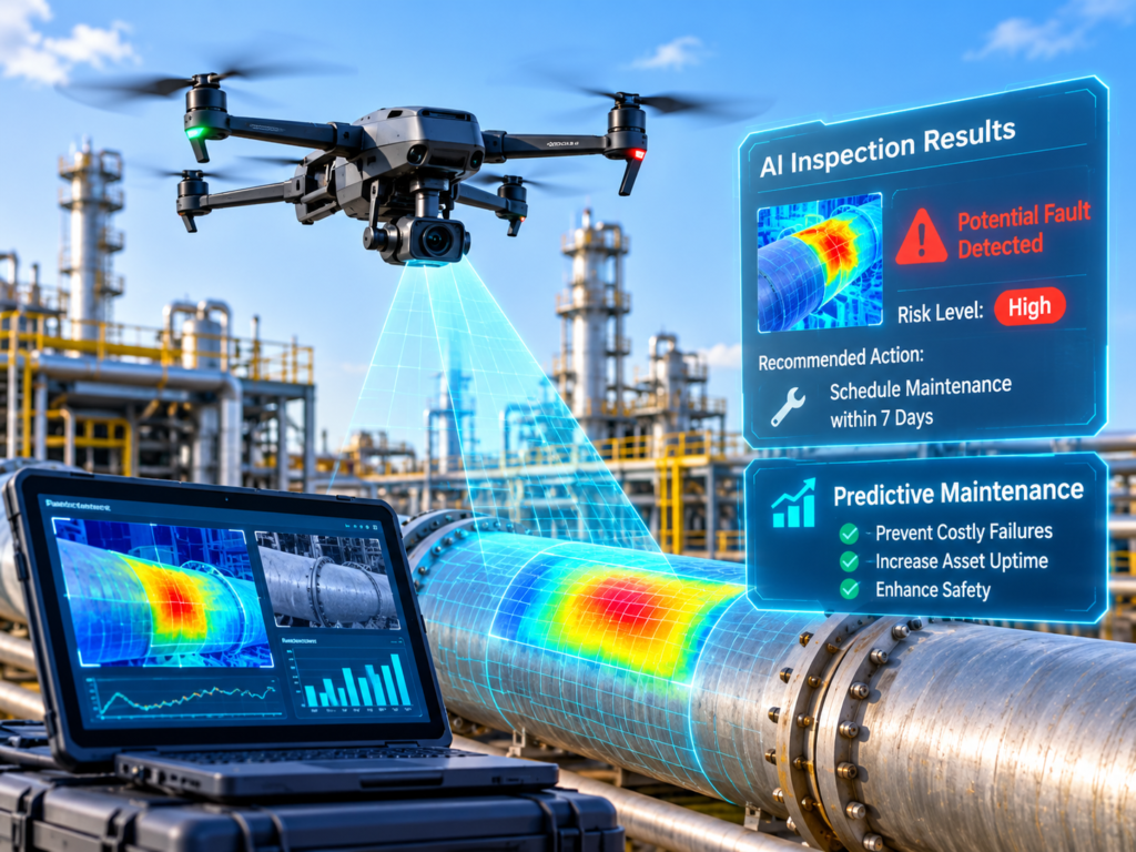
AI drone inspection uses drones equipped with cameras and specialized sensors to collect information about physical infrastructure. Artificial intelligence analyzes the captured data to flag possible defects, identify changes, and generate reports for engineering review.
Unlike conventional inspections, drones can reach difficult locations while reducing the need for workers to access potentially hazardous areas.
The process typically follows five stages.
Capture
Aerial data
Map
Spatial models
Analyze
AI findings
Inspect
Validation
Maintain
Actions
AI-assisted drone inspection workflow
AI-Powered Drones vs. Traditional Inspection Methods
Traditional inspections frequently depend on direct physical access. Engineers may need lifts, rope access, or scaffolding to examine elevated structures.
Drones can capture detailed visual information remotely, allowing inspectors to focus their physical assessments on areas that need closer examination.
|
Inspection factor |
Traditional inspection |
AI-assisted drones |
|---|---|---|
| Physical access | Often necessary | Reduced for visual checks |
| Data collection | Manual observations | Repeatable aerial imagery |
| Defect detection | Expert-led | AI-assisted, expert-validated |
| Reporting | Manual records | Structured digital reports |
| Main limitations | Access, time, safety risks | Weather, airspace, sensor limitations |
AI-assisted inspections don’t eliminate the need for engineers. They provide additional evidence that helps professionals investigate problems more efficiently.
How Computer Vision, Thermal Cameras, and LiDAR Work
The quality of an inspection depends heavily on the sensors used.
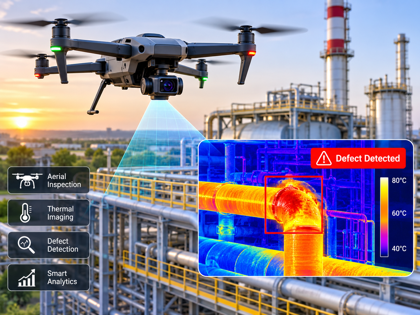
RGB cameras: Capture detailed images of visible cracks, corrosion, surface damage, and structural components.
Thermal cameras: Detect temperature patterns that may indicate overheating, insulation issues, or abnormal equipment behavior.
LiDAR sensors: Use laser measurements to create three-dimensional representations of structures and surrounding terrain.
Computer vision: Analyzes images to identify potential defects and changes that deserve further investigation.
An AI model may flag a suspicious surface crack, for example, but an engineer still needs to determine whether it represents a genuine structural concern.
This distinction matters because automated detection isn’t the same as a confirmed engineering diagnosis.
AI Drone Inspection Applications Across Industries
AI-assisted drones are increasingly relevant to infrastructure sectors where assets are difficult to access, geographically distributed, or expensive to inspect.
The most useful applications depend on the type of infrastructure, inspection frequency, and data required.
Power Lines, Substations, and Wind Turbines
Electrical utilities can use drones to inspect transmission towers, power-line components, and surrounding vegetation.
For operators in Houston, Texas, aerial inspections can support the identification of damaged components or vegetation encroachment without requiring physical access to every structure.
Offshore wind operators near Aberdeen, Scotland, can use high-resolution imagery to examine turbine blade surfaces. Renewable energy facilities around Hamburg may benefit from repeated visual monitoring of exposed infrastructure.
Thermal cameras can also highlight unusual temperature patterns in electrical equipment, although environmental conditions and sensor limitations must be considered.
Bridges, Buildings, and Construction Sites
Bridge inspections involve structural complexity and challenging access conditions.
AI-assisted image analysis can flag visible cracks, concrete deterioration, corrosion, and other surface changes that require an engineer’s attention.
Construction teams in London or California can also use repeated aerial surveys to compare site conditions, track progress, and document changes.
However, drone imagery cannot reliably detect every internal structural defect. Physical examination or nondestructive testing may still be required.
Oil, Gas, Manufacturing, and Industrial Facilities
Industrial drone inspections can support routine monitoring of storage tanks, pipelines, rooftops, manufacturing facilities, and solar installations.
At logistics facilities around Rotterdam, periodic aerial surveys can help maintenance teams compare surface conditions and identify developing defects.
|
Industry |
Typical sensors |
Useful outputs |
|---|---|---|
| Utilities | RGB + thermal | Equipment anomalies |
| Construction | RGB + RTK | Progress maps |
| Bridges | High-resolution RGB | Visible defect evidence |
| Renewable energy | Thermal + RGB | Hotspot investigations |
| Industrial facilities | RGB + LiDAR | Asset condition records |
The goal isn’t simply to collect more images. It’s to capture information that supports a specific inspection or maintenance decision.
AI Drone Mapping, Surveying, and Digital Twins
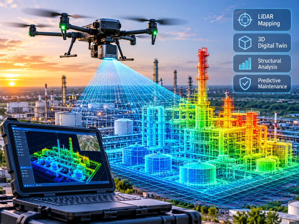
AI drone mapping transforms captured aerial data into geospatial information, including orthomosaic maps, point clouds, terrain models, and three-dimensional asset representations.
While inspection focuses on the physical condition of assets, mapping focuses on their location, geometry, and spatial relationships.
The same drone flight can sometimes support both purposes.
Drone Photogrammetry vs. LiDAR Mapping
Photogrammetry creates three-dimensional models from overlapping photographs. It’s particularly useful for construction sites, building exteriors, and textured surface models.
LiDAR measures distances using laser returns. It can provide useful geometric information for complex structures and certain terrain conditions.
|
Capability |
Photogrammetry |
LiDAR |
|---|---|---|
| Data source | Overlapping images | Laser returns |
| Main advantage | Detailed textured models | Geometric measurements |
| Vegetation | Limited ground visibility | Some canopy penetration |
| Typical application | Site mapping | Terrain and infrastructure surveys |
Neither technology is universally better. The choice depends on project requirements, ground conditions, required deliverables, and acceptable measurement uncertainty.
RTK, PPK, and Surveying Accuracy
Real-time kinematic (RTK) and post-processed kinematic (PPK) positioning technologies improve the georeferencing of drone data.
However, accurate surveying involves more than selecting an RTK-enabled aircraft.
Reliable results may also require calibrated sensors, suitable ground control, independent checkpoints, consistent processing, and documented accuracy assessments.
A drone’s advertised positioning precision should never be treated as proof that its final map meets a project’s survey requirements.
Connecting Drone Mapping with Digital Twins, GIS, and BIM
Digital twins connect representations of physical assets with relevant inspection and operational information.
Drone mapping platforms such as Drone Deploy and Pix4D support various geospatial workflows. GIS and building information modeling (BIM) systems can help organizations interpret those outputs alongside existing asset records.
Businesses can connect aerial datasets to custom dashboards and enterprise applications through web development services.
For a closer look at connected digital representations, explore Mak It Solutions’ digital twin guide.
How AI Drone Inspection Supports Predictive Maintenance
Predictive maintenance aims to identify developing problems before they lead to serious equipment failures or unnecessary disruption.
AI drones contribute by collecting repeatable observations of asset conditions.
When those observations are combined with historical inspections, maintenance records, and operating data, analytics systems can help teams understand deterioration patterns and prioritize maintenance.
AI Defect Detection and Thermal Anomaly Analysis
Computer vision models can highlight suspected corrosion, coating damage, cracks, or other visible deterioration.
Thermal analysis can reveal abnormal temperature distributions that deserve investigation.
However, a temperature difference doesn’t automatically mean equipment is faulty. Sunlight, reflections, ambient temperature, load, and sensor settings can influence thermal results.
Important findings should be validated by qualified professionals before they are used to make safety-critical decisions.
Turning Drone Inspection Data into Maintenance Predictions
Detecting a defect and predicting a failure are different tasks.
An AI model may identify corrosion on a storage tank, but that observation alone doesn’t establish when the tank will require repair or whether failure is imminent.
Useful predictions depend on reliable historical data, operating conditions, observed deterioration, and model validation.
Related edge AI technologies demonstrate how local processing can support industrial monitoring systems.
Integrating Drone Analytics with CMMS and EAM Systems
Inspection findings become more useful when linked to maintenance workflows.
For example, a validated anomaly can be associated with an asset identifier and submitted for review within SAP Plant Maintenance or another computerized maintenance management system (CMMS).
Enterprise asset management (EAM) systems can support broader asset tracking, maintenance history, and planning.
Organizations can also use business intelligence solutions to visualize inspection trends, condition changes, and maintenance priorities.
AI Drone Inspection Costs, ROI, and Software Selection
The cost of AI drone inspection varies according to equipment, sensors, software, staffing, regulatory requirements, and inspection frequency.
A low equipment price doesn’t necessarily mean a low operating cost.
What Determines AI Drone Inspection Costs?
Major cost factors include.
Aircraft procurement or outsourced inspection services
Thermal cameras, LiDAR, and other specialist sensors
Mapping, AI analysis, and reporting software
Pilot training, insurance, and required authorizations
Data processing, storage, and cybersecurity
Equipment servicing and replacement
Enterprise integrations and workflow customization
Autonomous drone-in-a-box systems may introduce additional costs for docking stations, communications, remote monitoring, and maintenance.
Businesses should evaluate total ownership and operating costs rather than comparing hardware prices alone.
How to Calculate Drone Inspection ROI
Return on investment (ROI) helps organizations compare the measurable benefits of drone inspections with their annualized costs.
Potential benefits include reduced physical access requirements, measurable inspection labor savings, fewer unnecessary site visits, and avoided downtime supported by reliable evidence.
For example, a utility may compare the cost of traditional tower inspections with a drone-assisted approach, while accounting for personnel, equipment, software, flight permissions, and follow-up engineering work.
Savings should be based on actual operational results, not assumptions that every AI-detected anomaly prevents a failure.
Choosing Enterprise Drone Inspection Software
Platforms and service providers worth evaluating include DroneDeploy, Skydio, Pix4D, Cyberhawk/iHawk, and HHLA Sky.
Their suitability depends on the inspection workflow rather than brand recognition alone.
Important selection criteria include mapping capabilities, AI performance, reporting quality, integration support, cybersecurity, data ownership, regional support, and operational requirements.
For custom processing workflows, Python development services can support analytics pipelines and integrations with existing systems.
A controlled pilot is often the best way to evaluate software before committing to a larger deployment.
AI Drone Inspection Regulations in the USA, UK, Germany, and EU
Commercial drone inspection operations must comply with the aviation rules and applicable privacy requirements of the jurisdiction where flights take place.
Regulatory obligations depend on the aircraft, operating location, flight conditions, operator qualifications, and potential risks to people and other aircraft.
USA.
In the United States, commercial small-drone operations generally fall under Federal Aviation Administration (FAA) Part 107.
Operators must consider remote pilot certification, aircraft registration, applicable Remote ID requirements, airspace restrictions, and flight permissions.
Beyond-visual-line-of-sight (BVLOS) operations generally require an applicable FAA waiver or other valid authorization when standard Part 107 visual-line-of-sight requirements cannot be met.
The FAA’s Part 107 guidance and waiver information provide official starting points for planning compliant flights.
Federal Aviation Administration+1
UK.
UK businesses must determine whether their planned operations fall within the Open category or require Specific-category authorization.
On April 23, 2025, the UK Civil Aviation Authority (CAA) introduced UK SORA as the risk-assessment route for relevant Specific-category authorization applications.
Operators should also review the CAA’s current guidance and any applicable changes before preparing an application.
Where inspection flights capture identifiable personal information, UK GDPR and other relevant privacy obligations must be considered.
The UK CAA Specific Category guidance explains the authorization framework.
Germany and EU.
Drone operations across the European Union follow a risk-based regulatory framework overseen at the European level by EASA, with national aviation authorities responsible for applicable implementation and approvals.
Operations in the Specific category may require authorization supported by the Specific Operations Risk Assessment (SORA) methodology or another applicable regulatory route.
Businesses in Germany should also evaluate national operating conditions, airspace restrictions, GDPR/DSGVO requirements, and appropriate data protection controls.
EASA’s Specific Operations Risk Assessment guidance provides further information about risk assessment and operational planning.
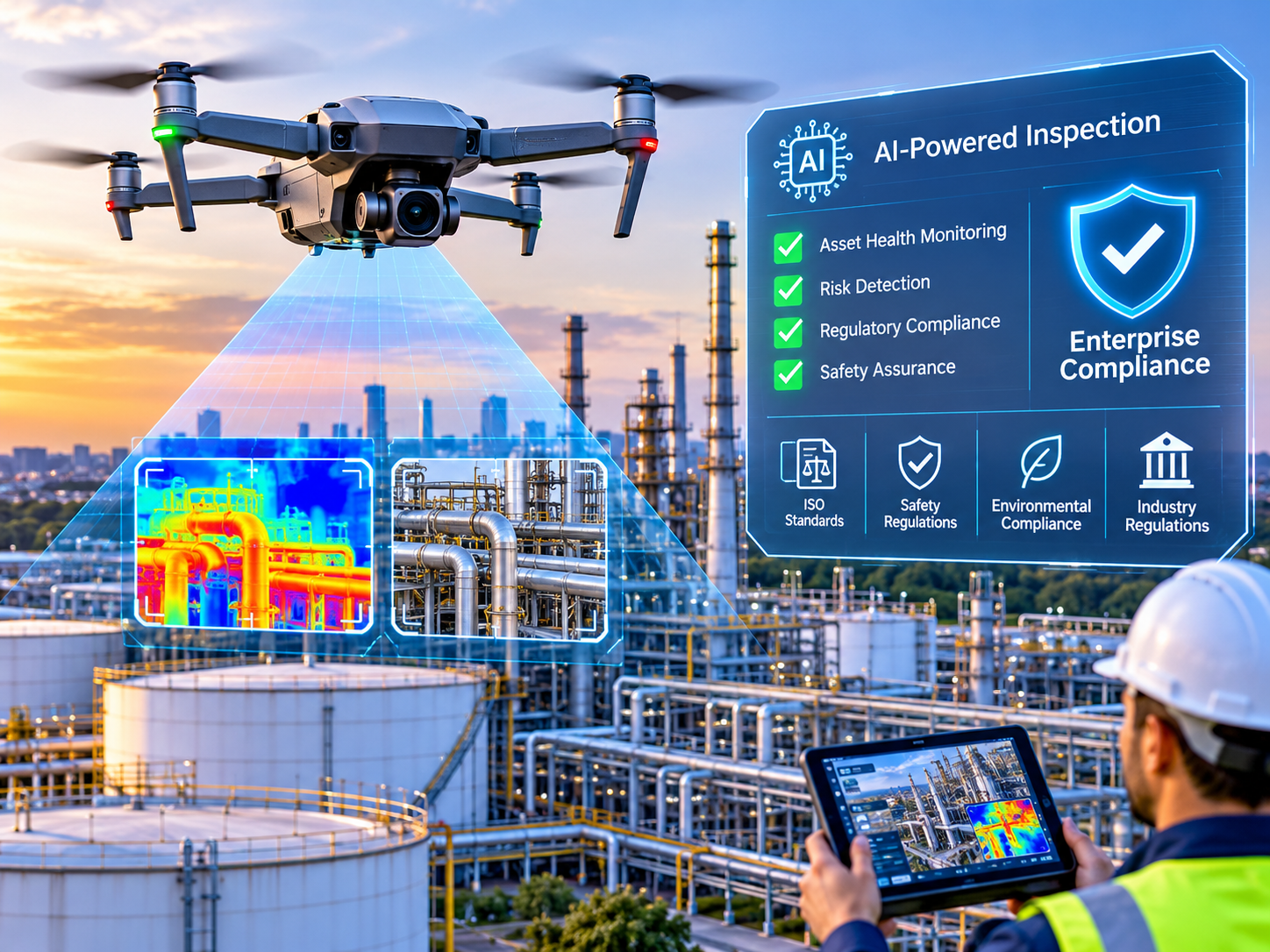
Across these regions, enterprise operators should also consider encryption, access controls, audit logs, and relevant ISO 27001 or SOC 2 assurance evidence where appropriate.
Regulatory guidance is subject to change. Confirm the requirements for each proposed operation with the relevant authority before flying.
How to Implement AI Drone Inspection Successfully
Implementing an AI-assisted inspection program requires clear goals, reliable data, regulatory planning, and measurable performance criteria.
A practical rollout follows three stages.
Define Inspection Goals and Success Metrics
Start with the problem you’re trying to solve.
Identify which assets need monitoring, what defects matter, how frequently inspections are required, and which sensors can capture the necessary evidence.
Set performance indicators such as inspection coverage, image quality, defect detection rates, false negatives, and cost per inspected asset.
Run a Pilot and Validate AI Results
Choose representative assets for a controlled trial.
Compare AI-generated findings with qualified inspector assessments and reliable ground-truth evidence.
Document missed defects, false positives, repeatability, and environmental conditions.
Expand only when the system demonstrates acceptable performance for its intended use.
Scale Operations and Integrate Maintenance Systems
After validating the pilot, develop operating procedures, staff training, cybersecurity controls, and reporting standards.
Connect inspection findings to existing maintenance systems and enterprise dashboards.
For technicians working on-site, mobile application development can support field inspection reviews, reporting, and maintenance workflows.
Moving from individual sites to regional fleets should depend on both operational readiness and regulatory compliance.
Final Words
AI drone inspection can help organizations turn aerial observations into actionable information for asset monitoring, mapping, and maintenance planning. Mak it sol
The value comes from combining reliable data collection with expert validation and systems that support everyday business decisions.
Mak It Solutions can help businesses explore custom analytics dashboards, AI-enabled data processing, and enterprise integrations that support drone inspection workflows.
Contact Mak It Solutions to discuss your technical requirements and assess how AI-powered inspection data could fit into your existing operations.
Key Takeaways
AI drone inspection combines aerial sensors, computer vision, and expert review to improve infrastructure monitoring.
RGB cameras, thermal sensors, photogrammetry, and LiDAR serve different inspection and mapping purposes.
Predictive maintenance requires historical and operational data, not just AI-generated defect alerts.
ROI depends on measurable operational benefits and total program costs.
Commercial inspections must meet applicable FAA, UK CAA, EASA, and privacy requirements.
A validated pilot provides a stronger foundation for scaling than deploying automation without testing.
FAQs
Q : Can AI drone inspections be performed without shutting down industrial operations?
A : Yes. Certain visual inspections can take place while facilities remain operational, provided safety conditions and permissions allow.
However, electrical hazards, moving machinery, restricted areas, and hazardous environments may require additional precautions or operational changes.
Q : How often should infrastructure assets be inspected using AI drones?
A : Inspection frequency depends on asset criticality, environmental exposure, maintenance history, and applicable regulations.
High-risk infrastructure may need more frequent inspections, particularly after severe weather or unusual operating events. Organizations should follow risk-based maintenance schedules rather than a universal inspection interval.
Q : Can AI drones detect small cracks or hidden structural damage?
A : AI drones can identify some visible surface cracks when image resolution, lighting, positioning, and model performance are suitable.
Standard optical cameras cannot reliably detect internal structural damage. Engineers may require physical examination or nondestructive testing to assess hidden defects.
Q : What cybersecurity and data ownership questions should buyers ask?
A : Buyers should clarify ownership of raw imagery, processed models, inspection reports, and AI-generated outputs.
Contracts should also address storage locations, retention periods, deletion rights, subcontractor access, encryption, audit logs, and permitted data use.
Q : Is outsourcing AI drone inspection better than building an internal team?
A : Outsourcing may be suitable for occasional inspections or projects requiring specialist equipment.
Internal teams can provide greater scheduling control when inspections are frequent and technical capabilities already exist.
A hybrid model can combine routine internal monitoring with specialist providers for more complex inspection requirements.